Helping design and engineering professionals discover, evaluate and specify technologies and processes that shorten the design cycle and enable success.
Alert!
Digital Engineering ceased publication on July 1, 2026. This website remains available as an archive of engineering content.
For inquiries or information, please email [email protected].
Public authorities in cities have deployed static stations to monitor air quality data for a set of pollutants with specific, high-cost sensing technologies. These stations provide highly accurate data, but their cost limits the quantity of deployments leaving large gaps in coverage.
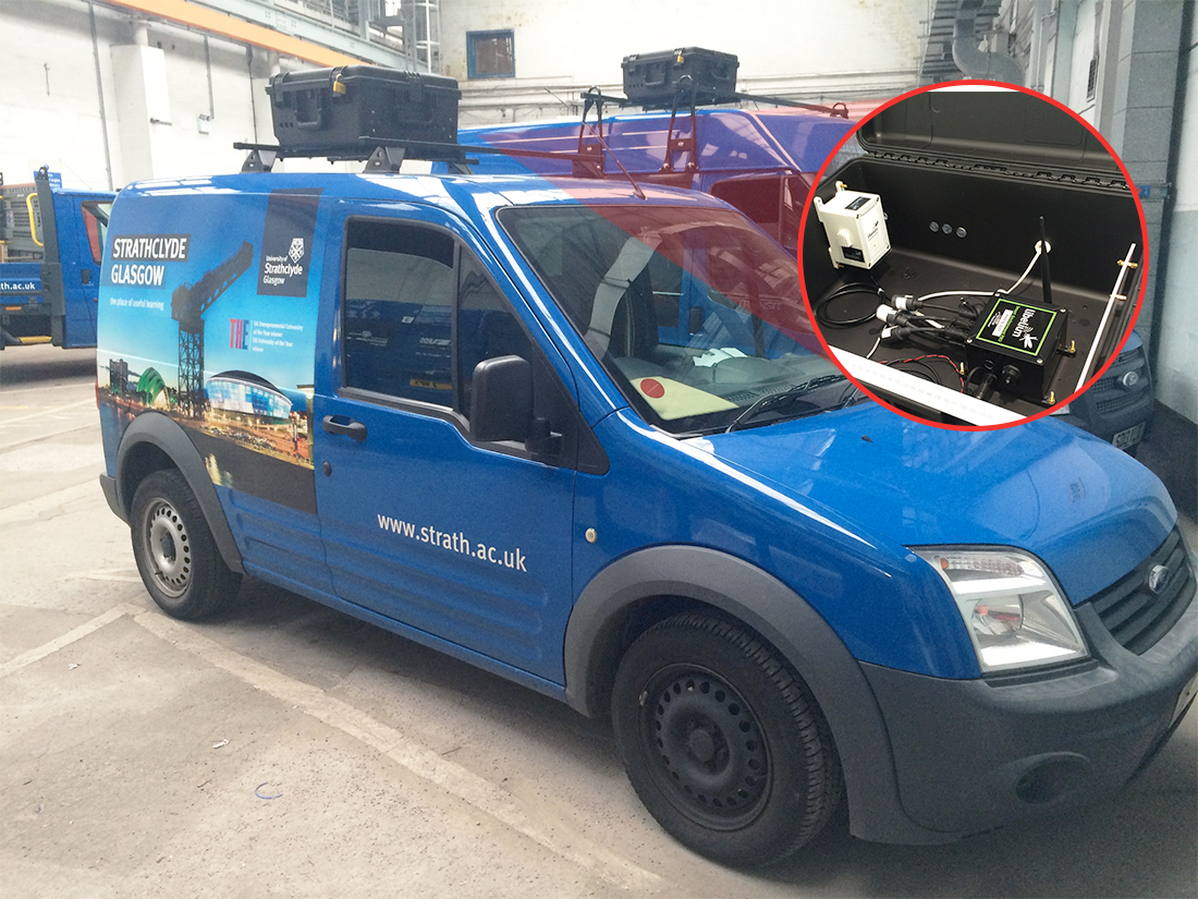
 Mobile air quality system integrated in vans. Image courtesy of Libelium/CENSIS.
CENSIS, the innovation center of excellence for Sensor and Imaging Systems (SIS) technologies, has developed a low-cost system with Libelium’s Waspmote Sensor Platform in Glasgow (UK) that can be deployed flexibly and rapidly in mobile configurations to complement static stations providing more clarity to “smart city” projects.
Sensors Monitoring Air Parameters Everywhere
CENSIS has worked in partnership with the University of Strathclyde on this project called “Sensing the City.” The aim was monitoring air parameters in different areas in a city, in a dynamic way, in real-time. In order to be dynamic, they thought of a mobile wireless sensor network system placed on the top of vans as they move throughout the city.
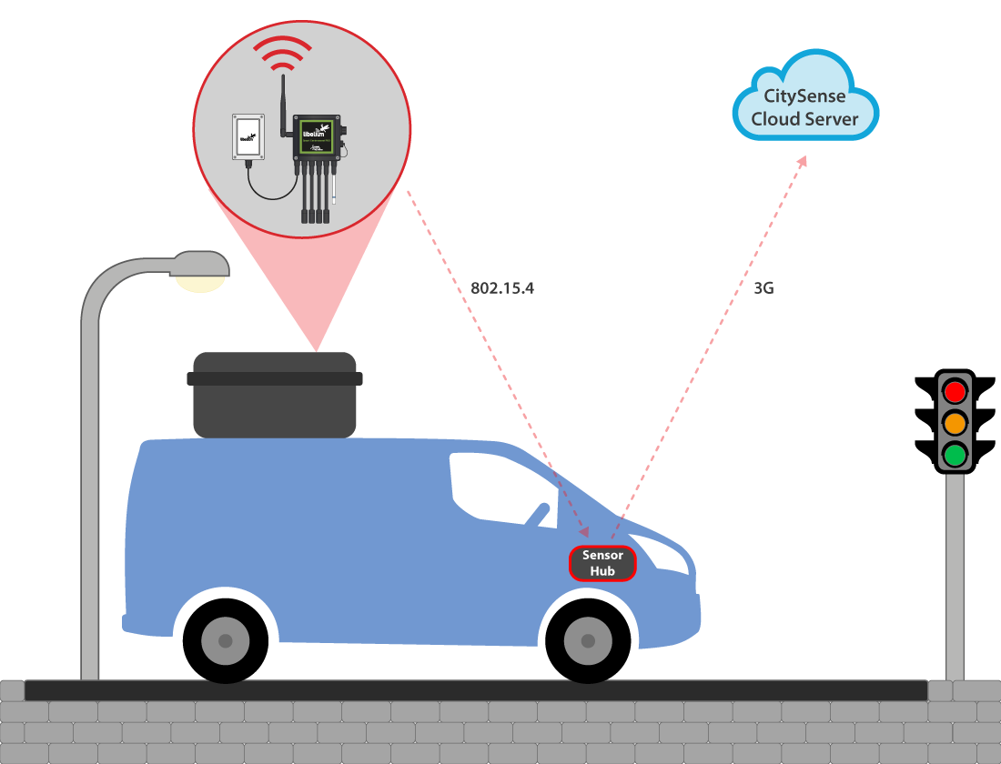 Air quality monitoring system functioning diagram. Image courtesy of Libelium/CENSIS.
“Our initial requirement was for sensor nodes with a variety of configuration options. From an evolution point of view, we now have the potential to add new sensor nodes or to change sensor nodes,” says Stuart Simpson, senior engineer at CENSIS.
The sensor node consists of a box with the Waspmote Plug & Sense! Smart Environment PRO inside and also the different sensors: CO, Particle Matter—dust sensor, (PM1, PM2.5 and PM10), temperature, humidity, pressure, NO, NO2 and O3. These are some of the most important parameters to control air quality and detect gas emissions or pollutants.
All the information monitored by the Waspmote Plug & Sense! Sensor Platform is sent to the sensor hub, located in the vehicle glove box, through 802.15.4. It is composed of Raspberry Pi2, a GPS antenna (to allow the tracking) and ZigBee. The information gathered is sent to the cloud via 3G and visualized in CitySense, based on the Microsoft Azure IoT platform.
CitySense is a web-based user interface that allows data visualization, interaction with the cloud services and includes capability to embed data processing and analytic outputs. The Decision Support System allows engineers to create spatial and temporal high-resolution air quality maps.
A Low-Cost Deployment with Great Possibility
The “Sensing the City” project can provide indicative air quality data in areas without coverage to support identification of pollution sources. Mobile systems can also gather data in a volume and with the rapidity required to support the comparison of pollution models and to identify trends.
The main functionalities of the system are:
 CitySense dashboard developed by CENSIS. Image courtesy of CENSIS.
Libelium technology “offers a large range of sensor nodes, which offer us the flexibility we need for the future,” says CENSIS’ Simpson. The project is currently in phase I with future plans to grow coverage, develop analytics, extend communication protocols and optimize sensor accuracy and sensitivity—and to test in a wider range of cities.
The next stage will also include other applications areas for “smart cities” apart from air quality such as road conditions monitoring, traffic management or energy conservation of buildings via thermal imaging. The final goal is to develop a system that is able to provide a complete solution for public authorities.
For more information, visit the following sites:

Join over 90,000 engineering professionals who get fresh engineering news as soon as it is published.


About Us · Contact Us · Editorial Team · Advertising · Privacy Policy · Subscriber Services · © 2026 Digital Engineering 24/7 · Peerless Media